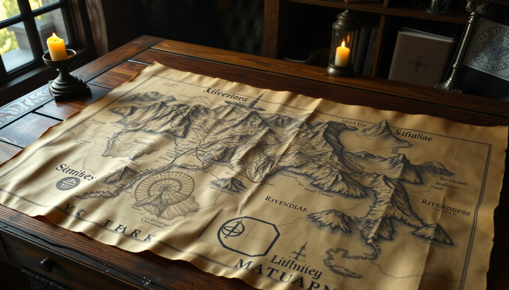
Map of Middle Earth – Regions, History and Interactive Guides
The map of Middle-earth stands as one of the most recognizable works of fantasy cartography in literary history. Spanning the fictional continents and regions crafted by J.R.R. Tolkien across The Hobbit, The Lord of the Rings, and The Silmarillion, these maps have guided generations of readers through the epic narratives of Middle-earth’s peoples, places, and perils.
Whether exploring the pastoral Shire, navigating the treacherous passes of Mordor, or tracing the journeys of the Fellowship, the map serves as an essential companion to Tolkien’s legendary tales. This guide consolidates everything readers need to know about Middle-earth cartography, from the map’s origins and major regions to interactive resources and key differences between various editions.
What Does the Map of Middle-earth Look Like?
The visual representation of Middle-earth encompasses multiple versions released across decades of publication. The foundational design stems from Tolkien’s original sketch maps, which appeared alongside the first editions of his works. These hand-drawn creations established the geographic framework that continues to define how readers visualize Tolkien’s world.
- Tolkien himself created the first official maps, treating geography as an integral part of storytelling rather than mere illustration
- The map spans Eriador in the west to Mordor in the east, encompassing diverse landscapes from peaceful farmlands to volcanic wastelands
- Christopher Tolkien, the author’s son, edited and refined subsequent editions, ensuring consistency with his father’s evolving vision
- Karen Wynn Fonstad’s Atlas of Middle-earth (1977) provided scholarly cartographic refinements that many editions now follow
- Film adaptations introduced new visual interpretations by artists like Alan Lee and John Howe
- The maps intentionally avoid strict mathematical scaling, as Tolkien varied distances for narrative pacing
- Barbara Halpern Strachey’s Journeys of Frodo (1981) created 51 hand-drawn maps tracking character movements across the lands
| Feature | Description |
|---|---|
| Geographic Extent | Eriador to Mordor spans approximately 1,400 miles |
| Publisher | HarperCollins editions feature official cartography |
| Digital Presence | Lord of the Rings Online (LOTRO) game features interactive mapping |
| Ancient Lands | Beleriand maps cover First Age territories now submerged |
What Are the Main Regions on the Map of Middle-earth?
Understanding Middle-earth’s geography requires familiarizing oneself with the major regions that shape the narrative landscape. Each area carries distinct characteristics, cultures, and strategic importance within Tolkien’s legendarium.
The Shire and Eriador
The Shire occupies the northwestern portion of Middle-earth, serving as the homeland of the hobbits. This pastoral region features comfortable villages, farmland, and rolling hills that provide stark contrast to the dangers encountered elsewhere. Surrounding Eriador contains the ruins of ancient kingdoms, including the abandoned city of Annúminas and the Weather Hills that separate the Shire from the wider world.
Rivendell and the Misty Mountains
Hidden among the western slopes of the Misty Mountains, Rivendell represents the Last Homely House east of the Sea. The elven refuge serves as a crucial waypoint for travelers journeying eastward. The Misty Mountains themselves stretch across the breadth of northern Middle-earth, creating a formidable barrier that includes the legendary Mines of Moria.
Mordor and the Dark Land
Located in the eastern reaches, Mordor represents the stronghold of Sauron throughout the Second and Third Ages. The region divides into three main areas: the volcanic plateau of Gorgoroth in the north, the fertile ash-plains of Núrn in the south, and the grim fortress of Barad-dûr that dominates the landscape. Natural barriers of mountain ranges surround Mordor on three sides, with only the Black Gate providing conventional access.
Gondor and the White Tower
The southern kingdom of Gondor stretches along the western shores of Anduin, featuring the fortress city of Minas Tirith, the abandoned White City of Minas Anor, and the ancient port of Pelargir. The region represents the last major stronghold of the Dúnedain and the primary defense against darkness from the east.
The Shire’s precise location places it in the northwest of Middle-earth, roughly aligned with modern coordinates corresponding to western Europe on Tolkien’s simplified projection. The region extends from the Far Downs in the west to the Brandywine River in the east.
Who Created the Map of Middle-earth and Its History?
The cartographic history of Middle-earth reflects both the creative vision of its author and the scholarly dedication of those who followed. Understanding this evolution provides insight into how Tolkien’s world developed across his literary career.
J.R.R. Tolkien’s Original Cartography
Tolkien began sketching maps alongside his earliest Middle-earth writings, treating geography as inseparable from narrative. His original drawings featured rough coastlines, mountain ranges, and place names that evolved throughout his lifetime. The map accompanying The Hobbit (1937) established initial conventions, while the Lord of the Rings maps expanded the known world significantly.
Christopher Tolkien and Posthumous Refinement
Following J.R.R. Tolkien’s death in 1973, Christopher Tolkien undertook the massive project of organizing and publishing his father’s remaining manuscripts. Through The Silmarillion and subsequent volumes of The History of Middle-earth series, Christopher preserved and clarified geographic details that his father had sketched but never formally published.
Karen Wynn Fonstad’s Scholarly Contribution
The 1977 publication of Fonstad’s Atlas of Middle-earth represented a significant milestone in fantasy cartography. Her scholarly research reconciled discrepancies between Tolkien’s various writings, creating reference maps that fans and scholars alike have relied upon for decades.
How to Download or Use an Interactive Map of Middle-earth?
Modern technology has produced numerous interactive resources that allow users to explore Middle-earth in unprecedented detail. These digital tools transform static map images into explorable environments suitable for both casual fans and serious scholars.
Comprehensive Interactive Map Resources
Several platforms offer detailed interactive experiences for exploring Tolkien’s world. LotrProject provides a high-resolution interactive map featuring toggleable displays for events, places, and character movements. The same resource offers a specialized Beleriand map covering the ancient lands from The Silmarillion, including detailed tracking of journeys such as Tuor’s path to Gondolin.
The Middle-earth Interactive Map plots over 100 events from The Silmarillion, The Hobbit, and The Lord of the Rings as clickable markers with detailed descriptions. Arda Maps delivers a community-driven experience visualizing all major Tolkien ages on a single platform.
For those focused specifically on the Third Age, Middle-Earth Map offers dedicated interactive exploration capabilities. Additional specialized visualizations come from creators like Micah Vander Lugt, whose work includes 3D terrain models and biome-based representations of Middle-earth.
When using interactive maps for study, consider starting with a specific character journey or event rather than attempting to explore the entire map. Tracking individual paths provides better understanding of geographic relationships than general browsing.
Interactive map resources are primarily available as web-based tools rather than downloadable PDFs. Official high-resolution maps for printing typically require purchase through authorized publishers such as HarperCollins.
Key Differences in Middle-earth Maps (Book vs. Movie)?
The visual adaptations of Tolkien’s works introduced notable changes to Middle-earth geography. Understanding these differences helps readers appreciate both the source material and the creative decisions behind film interpretations.
Scale and Distance Modifications
Tolkien’s maps deliberately avoid strict mathematical scaling, with distances varying for narrative effect. The journey from the Shire to Mount Doom covers approximately 1,400 miles in his calculations, but the pacing serves storytelling rather than geographic accuracy. Film adaptations sometimes compressed or expanded these distances to suit pacing requirements.
Visual Representation Changes
Artists Alan Lee and John Howe, whose artwork appears prominently in Peter Jackson’s film trilogy, brought their own interpretive vision to Middle-earth’s landscapes. Their maps emphasize atmospheric qualities and dramatic silhouettes that differ from earlier illustrated editions. The films featured original sets, locations, and visual designs that departed from existing map conventions.
Location Additions and Omissions
Film productions introduced locations never mapped in Tolkien’s original works, such as the expanded portrayal of Edoras and the fortress of Helm’s Deep. Conversely, certain locations from the books required significant visual adaptation or appeared only in supplementary materials rather than the primary narrative.
Evolution of Middle-earth Cartography
- 1937 – First Hobbit map published alongside initial edition
- 1954 – Lord of the Rings poster map released with the trilogy
- 1977 – Karen Wynn Fonstad publishes revised atlas
- 1981 – Barbara Halpern Strachey’s Journeys of Frodo maps appear
- 2001 – Film versions by Alan Lee accompany movie releases
- 2023 – AI-enhanced fan maps emerge in online communities
What Information Is Clear and What Remains Uncertain?
| Established Information | Information That Remains Unclear |
|---|---|
| Tolkien created original maps for all major works | Exact mathematical scale was never finalized |
| Christopher Tolkien edited posthumous editions | Precise distances between certain locations |
| HarperCollins publishes official editions | Status of certain minor locations in canon |
| Fonstad’s Atlas represents scholarly consensus | Geographic changes introduced by adaptations |
Understanding the Role of Maps in Tolkien’s World
Tolkien’s approach to geography differed fundamentally from casual world-building. The map of Middle-earth served as both narrative device and creative constraint, with geography shaping plot possibilities as much as events determined the shape of the land. Maps accompanying his works were not decorative additions but integral elements that readers consulted to track journeys, understand distances, and appreciate the scale of conflicts.
This cartographic consciousness extended throughout Tolkien’s career. His academic background in philology included deep familiarity with historical cartographic traditions, and he understood how maps could convey cultural relationships, historical layers, and the passage of ages. The lands depicted in his maps carry accumulated meaning from millennia of fictional history.
Barbara Halpern Strachey’s Journeys of Frodo (1981) represents perhaps the most comprehensive cartographic study of character movement, creating 51 hand-drawn maps that trace the Fellowship’s paths across Middle-earth. Her work demonstrates how detailed geographic analysis can reveal narrative patterns invisible to casual reading.
Sources and Expert Perspectives on Middle-earth Cartography
Tolkien wrote in the preface to The Lord of the Rings: “The facing pages in the Lord of the Rings may perhaps make clear to the reader the relation of the map to the story, and to the geography of the story as it was in my mind.”
— J.R.R. Tolkien, The Lord of the Rings Preface
Christopher Tolkien noted in his editorial work: “The maps were not afterthoughts but grew with the stories, part of the continuous development of Middle-earth.”
— Christopher Tolkien, The History of Middle-earth Series
The scholarly foundation for Middle-earth cartography rests primarily on Tolkien Gateway’s comprehensive documentation and the published works of Tolkien himself. The Tolkien Society provides additional resources for fans seeking authoritative information about the author’s world.
Summary: Exploring Middle-earth Through Its Maps
The map of Middle-earth represents far more than simple navigation tools. Through Tolkien’s careful geographic construction, these maps invite readers into a world where every mountain range, river, and kingdom carries accumulated meaning. Whether consulting official HarperCollins editions, exploring the interactive LotrProject maps, or studying specialized resources like Arda Maps, fans have access to unprecedented resources for understanding Tolkien’s creation. For deeper exploration of adaptations that brought these lands to visual life, consider learning more about The Great Gatsby Movie – Plot, Cast, Reviews Guide for context on how literary adaptations approach visual storytelling.
Frequently Asked Questions
Is the map of Middle-earth to scale?
Tolkien never established strict mathematical scaling for his maps. Distances vary according to narrative needs, and geographic proportions serve storytelling rather than geographic accuracy.
Where can I download a free map of Middle-earth?
Free interactive maps are available through resources like LotrProject and Arda Maps. Official high-resolution maps typically require purchase through publishers.
Where exactly is the Shire on the map?
The Shire occupies northwestern Middle-earth, west of the Weather Hills and south of the Lone-lands. The Brandywine River marks its eastern boundary.
What is the distance across Middle-earth?
The span from the western edge of Eriador to the eastern edge of Mordor measures approximately 1,400 miles based on Tolkien’s calculations.
Who is credited with the original Middle-earth map?
J.R.R. Tolkien created the original maps accompanying his works. Christopher Tolkien edited refinements for posthumous editions.
Are the movie maps different from book maps?
Film adaptations introduced visual changes to geography, landscapes, and location portrayals. Artists like Alan Lee provided original interpretations for the movies.
What interactive map resources are available online?
LotrProject, Arda Maps, Middle-earth Interactive Map, and Middle-Earth Map offer various features for exploring Tolkien’s world digitally.
Does The Silmarillion have its own map?
The Silmarillion includes maps covering the First Age, including the drowned lands of Beleriand. LotrProject offers a specialized Beleriand map for these regions.
More related posts
 How to Win Friends and Influence People: Principles & Summary
 U.S. Stock Market Today: Dow Plunges 1,000 on Oil Shock
 A Court of Thorns and Roses Book Series Order: Complete Guide
 Is Dick Van Dyke Still Alive? Age, Net Worth, and Career Update
 Motorcycle Dealers Near Me: Best in Dublin, Cork & Limerick
 IRS Tax Withholding Estimator 2025: How to Use It Correctly
 How to Take a Screenshot on a Chromebook: Complete Guide
 401k 2026 Contribution Limit IRS: $24,500 Employee Max